
Southern Lebanon: Is Israel Redefining “Withdrawal” Through a Belt of Strategic Heights?

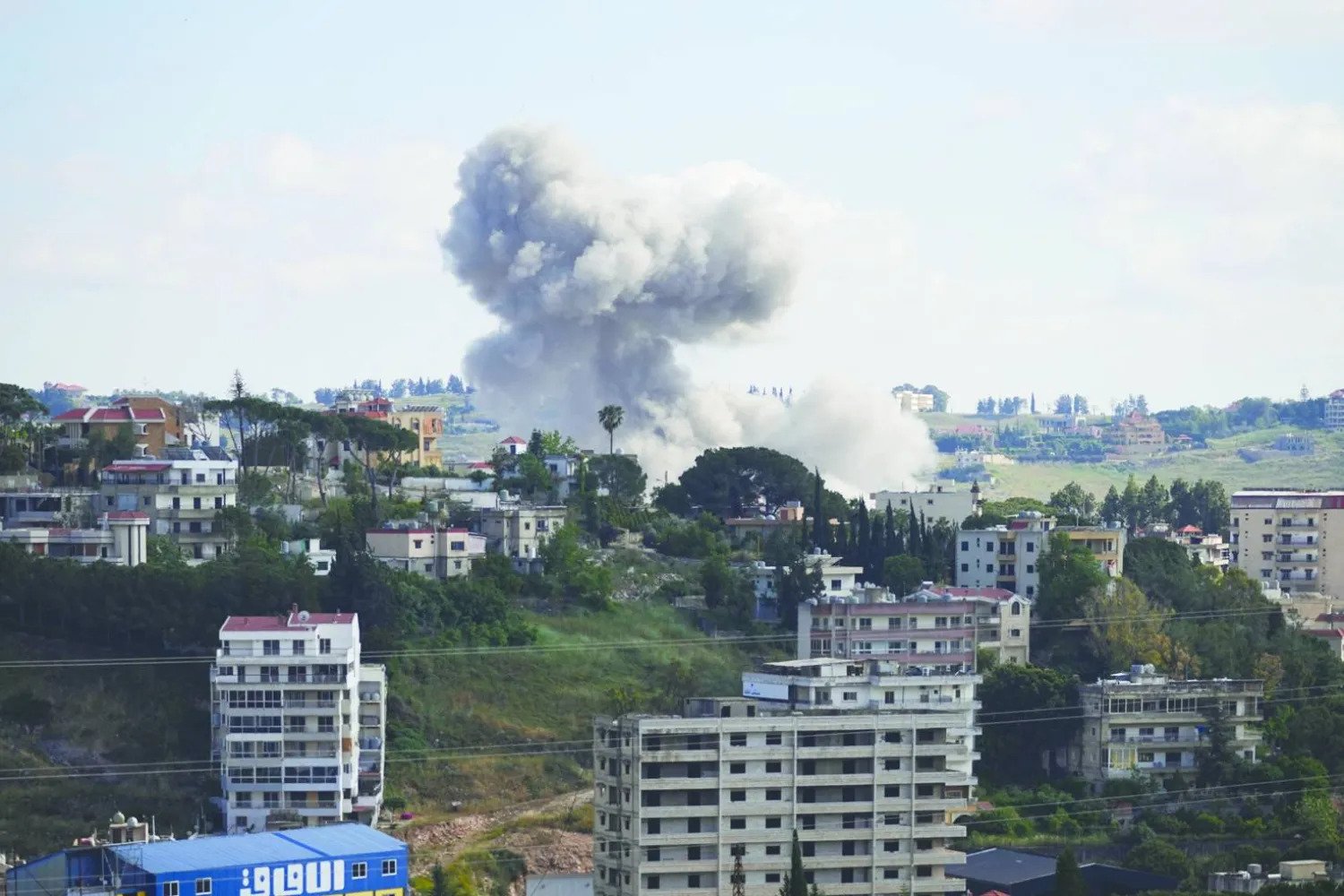
The question of Israel’s military presence in southern Lebanon is no longer confined to when Israel will withdraw or which areas it will evacuate. It is increasingly tied to a deeper issue: the nature of the security geography that Israel seeks to establish in the south. After decades of military and political experience, Israel appears to be attempting to redefine the very concept of territorial control. Rather than returning to the model of occupying a broad geographic strip, Tel Aviv may be seeking to hold a limited number of strategic heights and commanding positions that provide surveillance and fire-control capabilities while denying Hezbollah the ability to use those locations militarily.
There is, however, insufficient evidence to conclude that Israel has formally adopted a “belt of heights” doctrine, nor has it explicitly presented such an objective as an independent strategy. Yet an examination of the pattern of Israeli military operations in southern Lebanon—particularly the focus on the Shqif, Zawtar, and Ali al-Taher heights, among other locations—raises a significant military and political question: Is Israel seeking to turn geographic advantage into an alternative to large-scale ground deployment?
The hypothesis derives its significance from the nature of the conflict itself. Controlling a continuous geographic strip necessarily requires extensive ground deployment, the protection of supply routes, the defense of deployed forces, and the assumption of sustained human and logistical costs. By contrast, controlling a limited number of elevated and commanding positions can provide some of the same security functions without imposing the full burden of direct occupation.
This is precisely what gives the Ali al-Taher heights particular importance. They are not simply an elevated geographic feature, but a location of military value because of their commanding view over Nabatieh and areas toward Iqlim al-Tuffah, as well as their position within a broader network of heights capable of providing greater surveillance and influence over the surrounding area.
From a Security Strip to a Network of Commanding Positions
Israel’s movements in southern Lebanon can be understood by distinguishing between two different concepts of military control. The first is based on establishing a contiguous security strip, a model historically associated with Israel’s presence in southern Lebanon. The second focuses on controlling “commanding terrain”—heights and positions that provide an advantage in surveillance and firepower, even when they are not part of a continuous area of occupation.
Under this logic, the military value of a location is determined less by its size than by the strategic advantage it provides over the surrounding area. A hilltop offering visibility over a wide expanse can therefore be militarily more important than a much larger area situated on lower ground. Controlling a network of such locations could enable Israel to create a geographically discontinuous but functionally interconnected security zone.
This helps explain the focus on heights opposite Israeli communities. According to the assessment presented by retired Brigadier General Saeed Qazah, what Israel refers to as the “Yellow Line” is based on a series of elevated positions extending across the western, central, and eastern sectors. In this sense, the line resembles a defensive system based on terrain rather than a conventional territorial boundary.
The importance of such a line therefore lies not merely in the distance separating these heights from Israeli communities, but in Israel’s attempt to establish a zone separating population centers from locations that could be used for direct fire, surveillance, command, or logistical support.
Yet this concept does not necessarily mean that Israel intends to occupy every hilltop or establish permanent military positions on each one. The military function of elevated terrain can be achieved through different means: direct occupation, preventing the adversary from using it, maintaining surveillance over it, or pushing for arrangements under which the Lebanese Army or another security mechanism assumes control.
Ali al-Taher as a Test of a New Israeli Approach
Within this context, Ali al-Taher becomes more than just another location on the operational map. It could serve as a test of the nature of Israel’s emerging strategy.
If Israel’s objective is limited to temporary military operations designed to prevent Hezbollah from rebuilding its military capabilities, the strategic importance of the height could diminish as battlefield conditions change. But if military and political pressure continues to preserve Israeli access to the area or establish arrangements preventing Hezbollah from returning to it, this could indicate a broader transformation in Israel’s approach to security along its northern frontier.
The issue is particularly significant because control of elevated terrain cannot be separated from control of the military infrastructure surrounding it. Heights are not necessarily valuable in isolation; military headquarters, logistical facilities, defensive positions, and support infrastructure may be located below or around them.
The battle for the hills, therefore, is not necessarily a battle for the summit alone, but for the military system that the summit commands.
This also explains why a ground operation remains a difficult option for Israel. Capturing and holding these areas through ground forces would expose Israeli troops to ambushes and attrition and require the establishment of secure supply and defensive arrangements. By contrast, airstrikes, artillery, drones, and other stand-off capabilities allow Israel to exert pressure without incurring the same level of human cost, although they do not necessarily provide full territorial control.
Israel consequently faces a central dilemma: How can it translate firepower superiority into a stable security arrangement without becoming trapped in a broad ground occupation?
Human Costs and the Limits of Ground Control
If Israel has learned one lesson from its long experience in Lebanon, it is that occupation cannot be measured solely by the size of the territory controlled. It must also be measured by the cost of maintaining that control.
This is why control of elevated terrain could, if adopted as a broader strategy, offer Israel a way to reconcile two competing objectives: maintaining the ability to influence the Lebanese interior while reducing the need for extensive ground deployment.
But the success of such an approach is far from guaranteed. Heights do not provide security simply because they are occupied. If armed groups retain the ability to operate behind Israeli lines or target Israeli troops and positions, territorial control does not necessarily translate into military victory.
This is why the assessment of retired Major General Abdul Rahman Shehitle is significant. He argues that heights such as Ali al-Taher, al-Dabsha, and al-Shqif derive their military value from their ability to function as commanding positions for surveillance, direct fire, command, and logistical support. The struggle over these locations is therefore not merely about who controls the summit, but about who can incorporate it into an integrated military system.
Why the 2000 Model Is Difficult to Reproduce
These developments place the Lebanese demand for an Israeli withdrawal in a fundamentally different context from the circumstances Lebanon faced in 2000 and 2006.
On May 25, 2000, Israel withdrew from most of southern Lebanon after approximately 22 years of occupation. The decision was closely linked to Israeli domestic calculations and the rising cost of maintaining the military presence. UN Security Council Resolution 425, adopted in 1978, had already provided an international framework calling for Israel’s withdrawal, but the actual withdrawal took place without a peace agreement or bilateral security arrangements with the Lebanese government.
The situation in 2006 was different. Following the July War, the withdrawal was incorporated into a broader international framework embodied in UN Security Council Resolution 1701, which established arrangements for ending hostilities and strengthening the deployment of the Lebanese Army and UN forces in southern Lebanon.
The fundamental difference between the two experiences is that the 2000 withdrawal was primarily an Israeli decision to leave, whereas the 2006 outcome was part of an international arrangement designed to end a war and reorganize the security environment in the south.
Any potential Israeli withdrawal today faces an even more complicated question: What comes after the withdrawal?
Israel is unlikely to view the issue simply as a matter of redeploying forces geographically. It is likely to connect withdrawal to a broader question concerning who exercises military authority in southern Lebanon and how Hezbollah’s military infrastructure can be prevented from being rebuilt.
Lebanon, by contrast, insists on the principle of Israel’s withdrawal from Lebanese territory. The central dispute, therefore, is not simply about where Israeli forces will be located, but about the security arrangement that will govern southern Lebanon once they leave.
From the United Nations to Washington
One of the most important changes compared with 2006 is the transformation of the international environment surrounding the Lebanese file.
Following the July 2006 war, the United Nations, France, the Lebanese state, and Arab actors all played significant roles in producing the diplomatic framework that culminated in Resolution 1701. Today, however, the United States appears to occupy a more prominent position in managing negotiations and exerting pressure on the parties, while the role of the United Nations itself faces growing questions regarding its ability to enforce or guarantee new arrangements.
This shift changes the nature of the negotiations. In 2006, there was a clear Security Council resolution, a UN monitoring mechanism, and an enhanced international deployment. Today, any new arrangement would require much greater clarity over who guarantees implementation, who monitors compliance, and what mechanisms would prevent a return to the previous situation.
For this reason, discussing an “agreement” without specifying its implementation mechanisms can be misleading. The real dispute may not be over the principle of withdrawal itself, but over the line defining that withdrawal, who controls the areas evacuated by Israel, and what guarantees will prevent the re-emergence of the threat that Israel says it is trying to eliminate.
Is Israel Buying Time—or Redrawing Southern Lebanon?
From this perspective, possible Israeli delays cannot necessarily be explained solely by a desire to postpone withdrawal. Time itself can serve as a strategic asset.
Every additional day of military presence gives Israel an opportunity to gather intelligence, identify strategically valuable positions, degrade elements of military infrastructure, and improve its bargaining position ahead of any eventual negotiations. At the same time, however, prolonged military presence increases political pressure on Israel, particularly if the occupation becomes a source of sustained tension with Lebanon, Washington, and the broader international community.
Israel therefore appears to face a dual calculation: It does not necessarily want to reoccupy southern Lebanon in the traditional sense, but neither does it want to withdraw without security guarantees it considers sufficient.
This is where control of elevated terrain could emerge as a possible middle ground, although not necessarily a stable one: limited physical presence or the ability to access and influence commanding positions could provide Israel with strategic depth without reproducing the security-zone model that ended in 2000.
Beyond Ali al-Taher
The key question in the next phase, therefore, will not simply be whether Israel withdraws from southern Lebanon. It will be: From which southern Lebanon will Israel withdraw, to what boundary, under what arrangements, and who will fill the security vacuum it leaves behind?
If Ali al-Taher, al-Shqif, Zawtar, and other locations become enduring features of Israeli strategic calculations, the region could be witnessing a redefinition of the very concept of a “security boundary.” Rather than a continuous line, the boundary could increasingly consist of a network of positions capable of controlling movement, surveillance, and firepower.
That would make any future agreement considerably more difficult. Lebanon could regard Israel’s continued presence at any point on Lebanese territory as an occupation, while Israel could regard withdrawal without retaining the ability to control commanding positions as a return to the very threat it seeks to prevent.
The central dilemma in the next phase of the Lebanese-Israeli confrontation, therefore, may not be simply about drawing a new line on the map. It will be about reconciling two fundamentally competing conceptions of security and sovereignty: Lebanon’s demand for a withdrawal that restores full sovereignty over its territory, and Israel’s demand for a withdrawal that does not eliminate its ability to prevent that territory from once again becoming a platform for attacks.
Between these two visions, the battle for the hills of southern Lebanon could become one of the defining issues of the next phase. If the heights remain temporary military objectives, they will remain part of the current conflict. But if they become the foundation of a new geographic-security arrangement, the “belt of heights” may prove to be more than a description of the battlefield. It could mark the beginning of a deeper transformation in how Israel understands the security of its northern frontier—and in how Lebanon will have to negotiate the meaning, boundaries, and conditions of any future Israeli withdrawal.
Most read




Read also